
Situated at the confluence of the Feather and Yuba Rivers, Yuba County is home to some of California’s most ambitious water management and levee enhancement initiatives, safeguarding communities while fostering sustainable regional growth.
The Strategic Importance of Flood Protection in Yuba County
Yuba County’s geography has always been defined by its rivers. Flowing down from the Sierra Nevada snowpack, the Feather and Yuba Rivers nourish the fertile Sacramento Valley, driving the region’s agricultural economy and sustaining local ecology. However, this vast river network also presents significant seasonal hydrology challenges during heavy winter atmospheric river events.
Staying informed on yuba county regional flood control projects updates is essential for local residents, business owners, and property developers. Over the past two decades, local, state, and federal agencies have invested over $1 billion in public infrastructure to create one of the most resilient, technologically advanced flood risk reduction systems in the nation.
Key Infrastructure Projects & Levee Upgrades
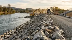
Comprehensive regional protection requires a multi-layered engineering approach. Local water districts and army corps engineers continuously upgrade levee walls, install underground cutoff barriers, and reinforce riverbanks across critical channels.
1. The Marysville Ring Levee Project
Surrounding the historic city of Marysville, the Marysville Ring Levee represents one of the region’s highest-priority engineering end endeavors. This multi-phase project involves installing deep soil-bentonite cutoff walls through the center of existing earthen levees to prevent under-seepage and strengthen structural integrity during sustained high-water events.
2. Feather River & Yuba River South Levees
Extensive enhancements along the Yuba River South Levee and the Feather River East Levee directly protect high-growth residential communities, including Linda, Olivehurst, and Plumas Lake. Recent improvements feature wide setback levees, slope-hardening riprap, and modern slurry walls designed to meet or exceed 200-year flood protection standards.
3. The Yuba Goldfields Mitigation
Located east of Marysville, the porous, gravelly terrain of the historic Yuba Goldfields has long presented an overland flood routing risk. Comprehensive engineering designs are actively addressing these high-elevation gravel mounds to create a continuous, unified barrier preventing uncontrolled river overflow into southern valley plains.
For real-time river level monitoring, project maps, and regional water management initiatives, visit the official Yuba Water Agency portal.
Advanced Reservoir Operations & Watershed Tech
Physical levees represent only one half of the regional safety equation. Modern flood risk reduction relies heavily on smart watershed management upstream at New Bullards Bar Reservoir.
Forecast-Informed Reservoir Operations (FIRO)
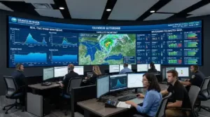
Through partnership with state climate researchers and federal meteorologists, Yuba County utilizes Forecast-Informed Reservoir Operations (FIRO). By pairing real-time atmospheric river forecasting with advanced telemetry, dam operators can strategically release water ahead of incoming storms, creating crucial storage capacity without compromising summertime water supply reserves.
Secondary Atmospheric Spillway Concepts
Planning continues for secondary spillway structures at New Bullards Bar Dam. These auxiliary gates will allow operators to release water lower in the reservoir before peak storm surges arrive, significantly reducing peak flow velocity downstream in the Yuba River channel.
Economic Impact & Community Development
Securing state and federal flood safety certifications does far more than protect lives and property—it acts as a primary economic driver for Yuba County’s future.
- Building Code & Permitting Relief: Achieving urban level of flood protection (200-year compliance) removes restrictive federal building moratoriums, enabling local property owners to renovate, expand, or build new homes.
- Reduced Insurance Costs: Certified levee systems significantly lower mandatory flood insurance premiums for residential and commercial policyholders in urbanized zones.
- Attracting New Business Investment: Infrastructure certainty gives commercial developers confidence to build retail centers, industrial parks, and distribution facilities near major transportation arteries like Highway 65 and Highway 70.
How Residents Can Stay Informed and Prepared
While regional levees are stronger today than at any point in California history, individual emergency preparedness remains a vital responsibility for every household.
1. Register for Emergency Alerts
Sign up for CodeRED or local emergency notification systems through Yuba County Emergency Services to receive instant phone, text, and email alerts during severe winter weather events or high-water warnings.
2. Monitor Local Waterways
Residents living near river corridors can track live stream gauge readings, reservoir storage levels, and weather outlooks via official county and state water resource dashboards.
3. Prepare Household Contingency Plans
Maintain an updated family emergency kit containing bottled water, non-perishable food, flashlights, portable power banks, important personal documents, and necessary medications in case of unexpected localized power or transit disruptions.
A Resilient Future for Yuba County
The ongoing regional flood control updates across Yuba County demonstrate what can be accomplished through dedicated public planning, innovative civil engineering, and proactive community investment. By continuously fortifying levees, implementing modern atmospheric forecasting, and expanding public safety outreach, Yuba County remains well-positioned for a safe, prosperous, and climate-resilient future.